After a break of nearly one and a half year we finally
planned for a trek, this time it was Siddhagad. One day because of time
contrainst that we city dwellers always have. Neeraj(aka Raja), Santosh(aka
Santy), Himanshu( aka Joshi) and myself were the members for this trek.
Siddhagad is hill fort situated in Thane district and one
hour drive from Murbad. It is surrounded by Gorakhgad and Bhimashankar and lies in Bhimashankar wildlife reserve. So be sure the trek moves through dense
vegetation and overgrowth.
 |
| The route to the base village |
We met at Dadar station(CR) pf.4 at 07.15 am and took
Badlapur Fast to Kalyan. Being a long weekend and a
Saturday, the train was comparatively less crowded. It took us to Kalyan by 8.25 am. After alighting there, we proceeded
to a restaurant to have a quick breakfast. I had Idli chutney while the other
three had Missal Pav. Kalyan ST depot is just outside the railway station on
the west side. We were lucky this time that we got a Murbad bound ST bus. Again very
sparsely crowded. There are frequent buses available for Murbad. So the waiting
time is very less at Kalyan depot. It takes exactly an hour to reach Murbad
depot. We reached there at 10.30 am. Now, there are two options available to
reach Narivali, the base village. One is the ST shuttle service to Narivali-Dehri
and the other is share taxi/ jeep. We were told that the bus to Narivali will
leave only after 11 am, so we opted for the share taxi. These guys take
you to Mhasa, around 12 km from Murbad. From there a second share cab to
Narivali( ~5 km). They charge you around 15-20 bucks per seat. Around 18 people
are squeezed into that vehicle for a bumpy ride. It takes further 45 min to 1
hr from Murbad to reach Narivali.
 |
| Siddhagad head on |
Just ask any local for your heading and you will be
on your path to Siddhagad. To the left you can see Gorakhgad mountain and to
your right is Siddhagad. The initial path moves between these two peaks for
about 2 kms after which it starts climbing after crossing a village. Again just
ask for directions just to make sure you are on the right path. There is a very
less chance of meeting any local after crossing the village, so need to be
careful with the path. There are multiple trails which split and join you. So
it is easy to lose track, which exactly happened to us. Around 30 mins into the trek we found ourselves at a small stream soon realising that this
cannot be the way up. So after cooling ourselves at the waters we again
retraced the route to a cross road. Moving forward for another half an hour we
were at the centre of a dried up water path. Though we knew this wasn’t the way
up, it was a very pleasant spot to relax. So we decided to have our lunch here.
Our lunch included chutney sandwich, cucumber, khichdi and chakli. There we met
a lone trekker who was also looking for the right path like us. The place was
so relaxing that few of us were in no mood to proceed further. After debating
on that for a while, we decided to keep searching for the right trail and move
further. So retracing back a little, we soon found a cross road and a arrow
guiding this way up!
 |
| (L-R) Neeraj, Joshi, Santy and yours truely |
 |
| On the way to Siddhagad machi |
The arrow is always a welcome sign. Infact the route is well
guided with arrows. So if you don’t see one, be sure that you have missed out
something. From here, it was an hour climb to the ancient fort door. The walk is
well routed but very exhausting. The old structure offers you a good background
for some selfies. Himanshu was too tired to move further to the village of
Siddhagad machi. His constant blabbers were completely ignored by us. So he
didn’t have much of an option but to keep walking :P
 |
| The entrance door |
It is a 15 min plain walk to the village of Siddhagad machi
from the darwaja. This was our pitstop for today. We must have reached there by
4 pm, refilled our water bottles and after a small chit chat with the local boys
again started our return jouney. They say an hour or so of rock climbing from Siddhagad machi leads to the fort. But looking at the huge mountain behind
we didn’t think it was a good idea to take that climb, may be next time if we
come.
The decent is pretty fast as the probability of losing
track is almost nil. The total descend time must be around one and a half hour
with occasional ‘selfie’ halts. We crossed the base village around 6.15 pm. It
was almost dark by then. So we decided to have a small snack break in one of
the small dry paddy field enroute. From there it was an uneventful 30 min walk
in the dark to the access road. At the bus stop, we got a direct service to
Murbad and from there to Kalyan. Took 9.08 CST fast and concluded our one day trek
at Dadar, completely exhausted and fully refreshed.
Here are some snaps...
Time line for the trek.
Dadar stn 07.15
Kalyan 08.25
Left for Murbad 09.30
Reached Murbad 10.30
Share jeep to Narivali via Mhasa 11.40
Crossed base village 12.15
Lost our way 1st time at 13.00
Retraced back to the dry water stream 14.00
Lunch and rest till 14.45
Got back on the route by 15.00
Reached Siddhagad machi 16.00
Descend started 16.30
Crossed base village 18.05
Snack break till 18.30
Bus stop 19.00
Murbad 20.00
Kalyan 21.00
Dadar 22.00
Home 22.15
--The End--

 Nirgudpada is a small sleepy hamlet with some 15-20 huts. A well-marked trail moves towards the fort soon after the village. Initial climb is through some over growth which provides adequate shade from the afternoon sun. I had bought a small plastic bag with me and while climbing I converted it into an eco-bag by putting whatever trash I found on the trail. It mainly included plastic wrappers and bottles. It was my bit to help clean the surroundings. After an hour of climb, we realised that it should take a little over an hour to reach the top. So we set a target time of 2 pm. The climb is just like any other trek till you reach the vertical rock patch that leads to the fort door. Just before that we found a local villager at a stall. We refreshed ourselves with lemon juice and proceeded towards the rock patch. I had read and seen many pictures about this one which appeared to be a little scary. So I kept my wallet and phone in my bag pack and tied my shoe laces tight just to gear up for the ascent.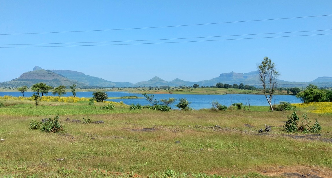

 Nirgudpada is a small sleepy hamlet with some 15-20 huts. A well-marked trail moves towards the fort soon after the village. Initial climb is through some over growth which provides adequate shade from the afternoon sun. I had bought a small plastic bag with me and while climbing I converted it into an eco-bag by putting whatever trash I found on the trail. It mainly included plastic wrappers and bottles. It was my bit to help clean the surroundings. After an hour of climb, we realised that it should take a little over an hour to reach the top. So we set a target time of 2 pm. The climb is just like any other trek till you reach the vertical rock patch that leads to the fort door. Just before that we found a local villager at a stall. We refreshed ourselves with lemon juice and proceeded towards the rock patch. I had read and seen many pictures about this one which appeared to be a little scary. So I kept my wallet and phone in my bag pack and tied my shoe laces tight just to gear up for the ascent.